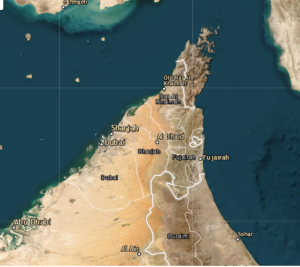
Costal Erosion of Fujairah Emirates using Remote Sensing and GIS
Coastal erosion is a pressing issue that threatens the natural beauty, ecosystems, and communities in Fujairah Emirates. As a coastal region, Fujairah is particularly susceptible to erosion due to its exposure to sea-level rise, wave action, and various human activities. To effectively address this challenge, it is crucial to employ advanced technologies such as remote sensing and Geographic Information System (GIS) tools. This study aims to explore the application of remote sensing and GIS in assessing coastal erosion in Fujairah Emirates. By analyzing erosion patterns, identifying contributing factors, assessing impacts, and proposing mitigation strategies. Remote sensing refers to the collection of information about an object or area without physical contact. It involves using various sensors, such as satellites or aircraft-mounted devices, to gather data from a distance. These sensors capture electromagnetic radiation, allowing us to analyze and interpret the information for different applications. In the context of coastal erosion assessment, remote sensing provides valuable data about the coastline's changes over time. It enables us to monitor shoreline shifts, erosion rates, and sediment movements, among other crucial parameters.
To assess coastal erosion in Fujairah Emirates, a combination of remote sensing and GIS techniques can be employed. Satellite imagery, aerial photography, and LiDAR (Light Detection and Ranging) data can provide detailed information about the coastline's morphology and changes over time. Field surveys and ground truthing are also essential for accurate validation and calibration of remote sensing data. Collected data is processed. It involves georeferencing and digitizing shoreline positions, creating digital elevation models, and conducting spatial analysis to detect erosion hotspots and trends. By analyzing these datasets and applying statistical models, we can gain insights into the underlying factors affecting coastal erosion and make informed predictions for future changes. By analyzing historical data, we can determine the rates at which erosion has occurred along the coastline of Fujairah Emirates. This analysis will help identify areas that have experienced rapid erosion, enabling us to prioritize protection measures and conservation efforts.
In conclusion, remote sensing and GIS technologies have proven to be invaluable tools in understanding and managing coastal erosion in Fujairah Emirates. Through the analysis of erosion patterns, identification of contributing factors, and assessment of impacts, this study may shed light on the urgency of implementing effective mitigation strategies. To ensure the long-term sustainability of the coastal areas in Fujairah, it is recommended to continue monitoring and studying the evolving erosion patterns, considering both natural and anthropogenic factors. Future research should also focus on evaluating the effectiveness of different coastal protection measures, promoting sustainable development practices, and raising awareness among local communities. By adopting a comprehensive and proactive approach, Fujairah Emirates can mitigate the adverse effects of coastal erosion and safeguard its coastal ecosystems and communities for generations to come.